Final blueprints for re-drawing NI's political map revealed


One key element is that a 2016 proposal to reduce Belfast’s current four constituencies to three has been definitively scrapped.
Instead, the original four – north, south, east and west – have been kept, albeit with some alterations to the boundaries.
Advertisement
Hide AdAdvertisement
Hide AdFor example, under the plans, Belfast West will stretch further into Lisburn; Belfast North will take in small sections of Newtownabbey including as far as the edge of Jordanstown; east Belfast will take in Holywood; and the south of the city will stretch out into the countryside as far as Moneyreagh and Drumbo.
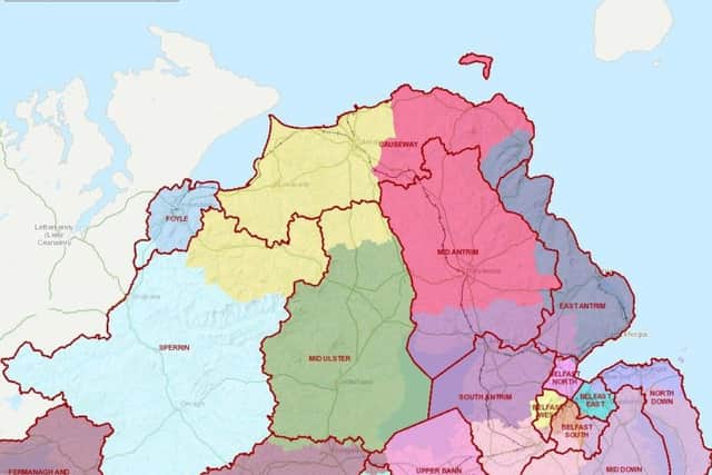
In the north-west, a plan which would have divided the village of Dungiven into two different constituencies along its Main Street has likewise been abandoned.
Instead it will sit within the northern boundary of a huge new constituency called Sperrin.
It will now be up to the Westminster Parliament to either approve or reject the plans wholesale.
Advertisement
Hide AdAdvertisement
Hide AdIf approved, the new borders are expected to be in place for any new Stormont or Westminster elections.
If not, it could be several years before the borders are tinkered with again.
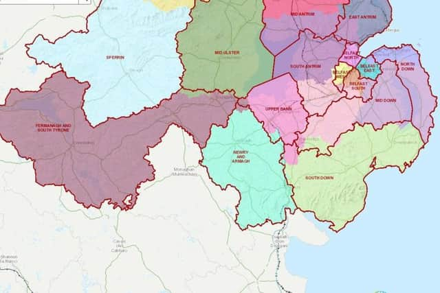
The exercise is part of a UK-wide move to cut the number of constituencies down, with NI’s number falling from 18 to 17.
More to follow.